If mischief is to be prevented, a channel must be maintained.
Report of the Royal Commission , 1866, D/TC/I1/1/1
The River Thames is no stranger to flooding, though many of the great historic floods have impacted the tidal river alone. The Report of the Royal Commission on pollution in 1866 also touched on drainage and flooding, and it categorised floods in the Thames Valley as either ordinary – ‘preventable by common care’ – or extraordinary – ‘requiring special means of protections’.
Ordinary floods
The Royal Commission identified one of the main causes of ordinary floods as neglect of the river channel. Over time, silt built up within the river, particularly in the natural hollows along its bed. This silt build-up could create obstacles and lead to local flooding.
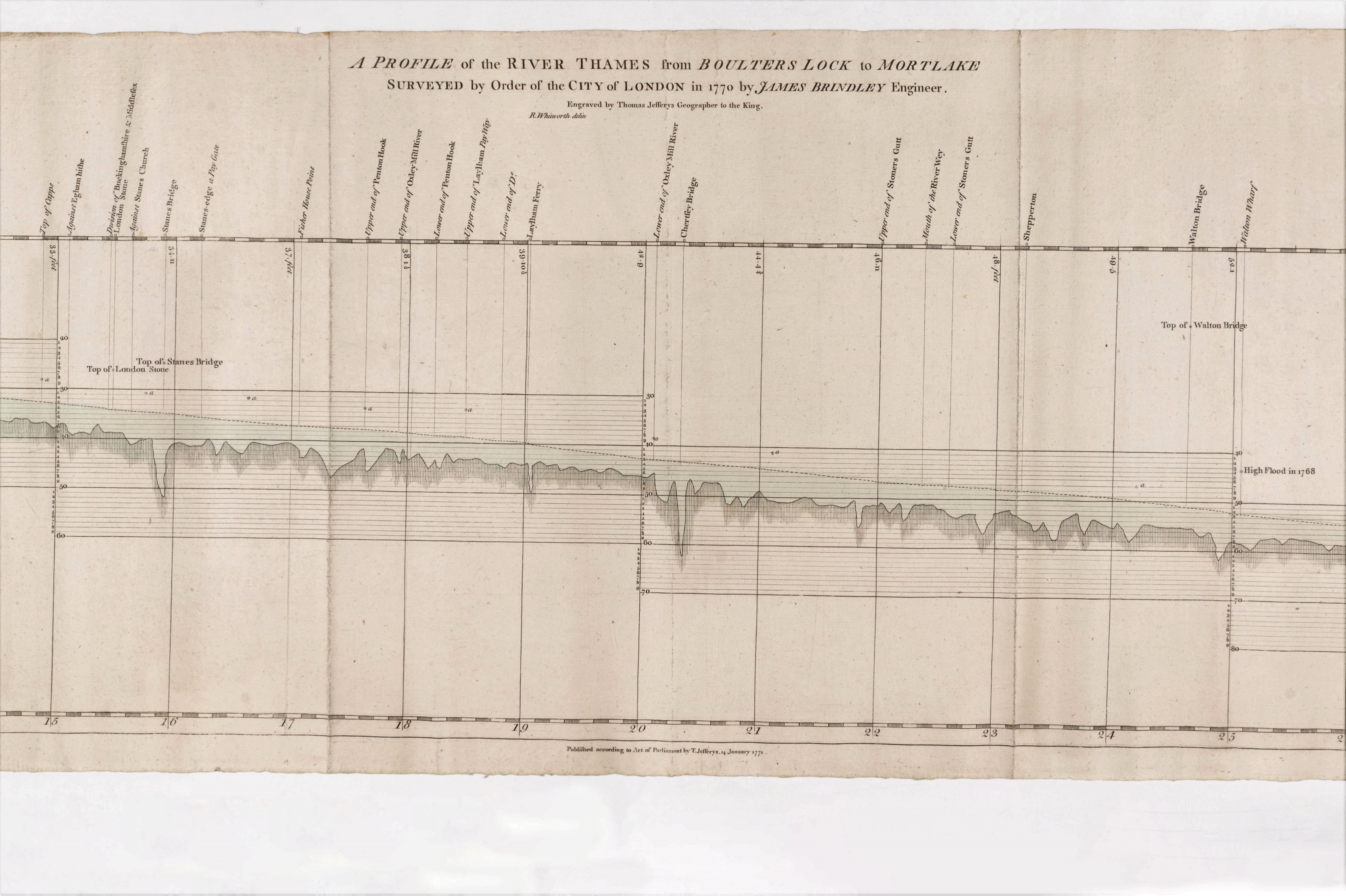
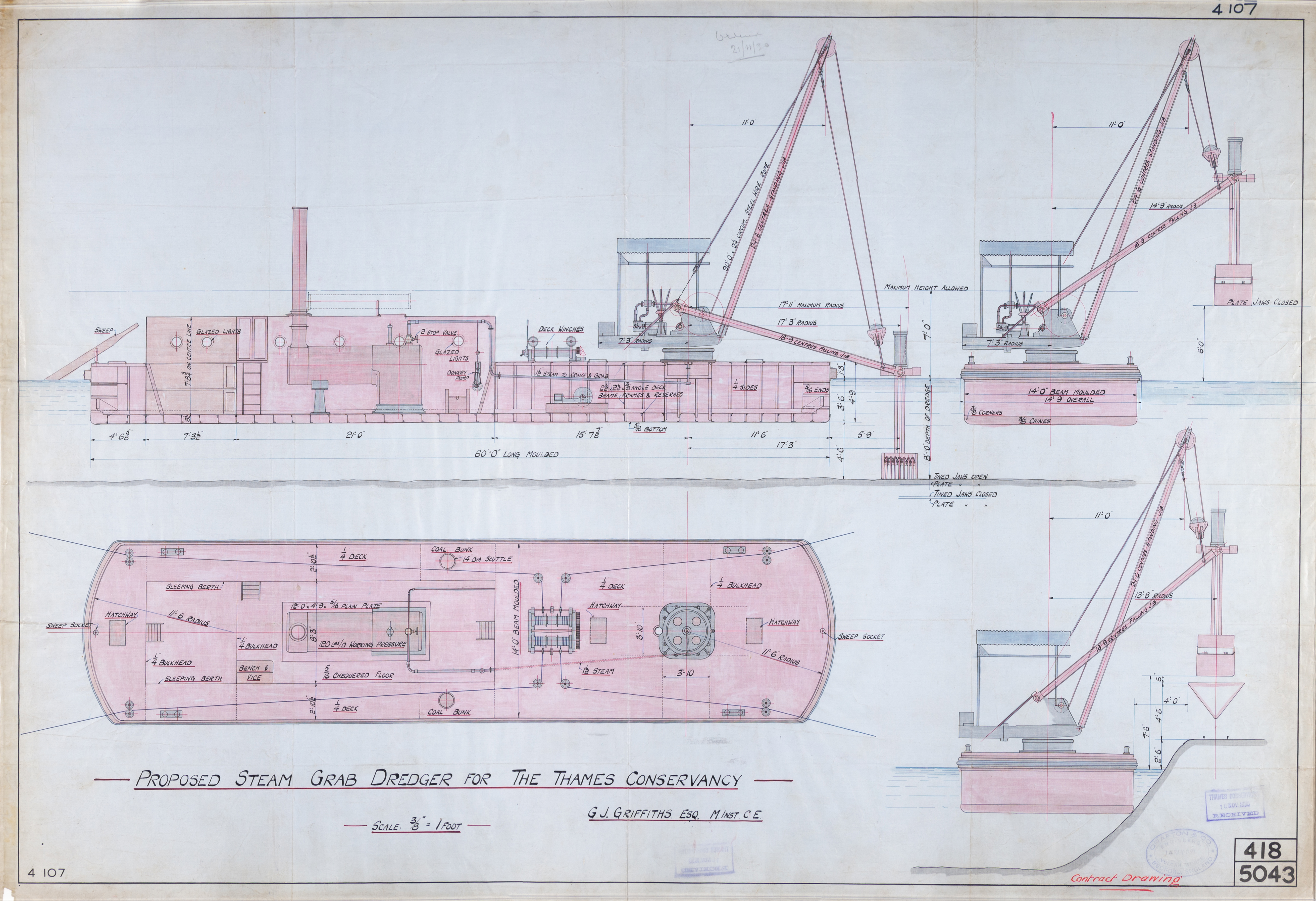
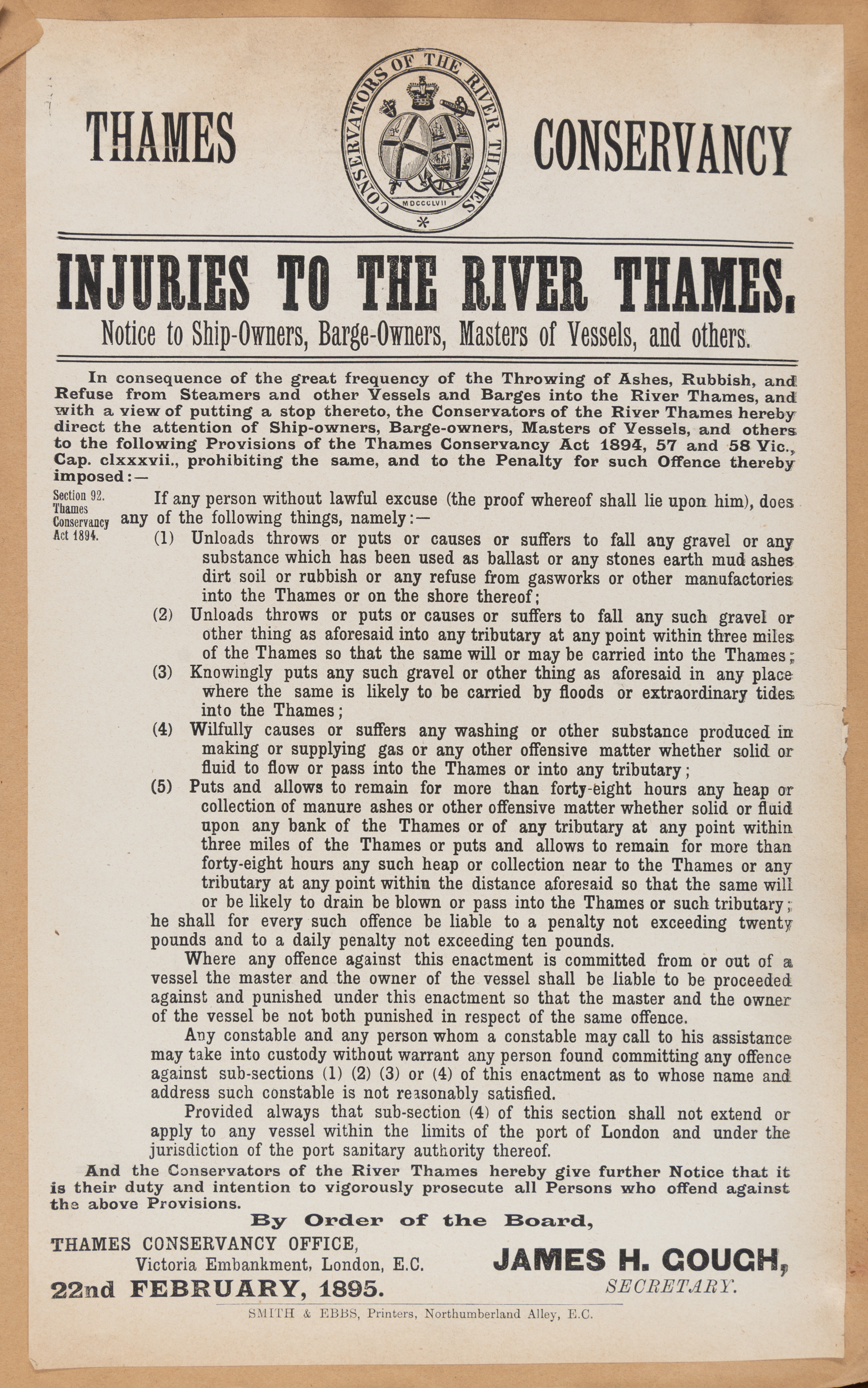
The solution was to dredge the river. Both the Commission and the Conservancy used dredgers to lift material from the river channel, creating greater depth of water and allowing for drainage. Barge owners were also fined for dumping stones or gravel into the Thames.
Another cause of ordinary floods were weirs. Before 1866, many weirs were in private ownership, used to aid mills and fisheries along the river. But appropriating the water flow could saturate the nearby land and obstruct natural drainage.
‘Some of the weirs retain a head of water so as to prevent land-drainage, and permanently to waterlog large areas of agricultural land on both margins of the river. At Oxford the suburbs and even urban portions of the city are at times seriously, and as regards the health of the inhabitants dangerously, flooded by reason of the impediments offered to a free flow of the flood-water by Sandford and other weirs. Other towns and villages and large tracts of agricultural land are injuriously inundated by flood-water from similar causes, and because there are no retaining embankments, or systematic main and tributary outlet drains provided to keep the river within defined limits’.
The Conservancy brought the weirs into public ownership, removed those it could and redesigned others. Maintaining weirs became an important part of its duty and the failure to do so created almost immediate problems.
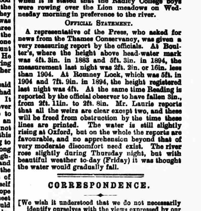
In early January 1912, heavy rainfall raised the river levels between Chertsey and Sunbury Locks, and the Conservancy received a complaint from the novelist, Thomas Mullet Ellis, about their lack of action. Mullett Ellis, who lived beside the river at Creek House, Shepperton, complained that he had been flooded because weir sluice gates had not been opened to disperse the rising water:
‘At Chertsey the flood has never been subsided, and yet during that time of flood it will not be disputed I am sure that the sluice gates were frequently put down; for instance, on the 1st January this year I went down to Sunbury and saw that there were two gates down at the weir. The flood had not subsided by any means. There was still a considerable state of flood on the 1st January. Then, again, I went down on the 4th January, and then six gates were down, still the flood had not completely subsided by any means.’
Minutes of proceedings of a public inquiry with reference to a complaint made by Mr T. Mullett-Ellis relating to flooding of the River Thames (1912), D/TC/I2/4
He succeeded in obtaining a public inquiry into the floods. The Conservancy Board responded:
‘Mr Mullett Ellis, as you come here, I may say that we have a lot of figures which we have taken out for your information, but may I say this, that, of course, the Thames Conservancy Board are only too anxious to co-operate with the people who live down by the river. They do all they can for them, and if any fault of judgement or neglect of duty is pointed out to them they are only too anxious to remedy it. The Board is grateful to anyone who draws their attention to anything that is not properly done.’
Extraordinary floods
The earliest well-documented extreme flood along the upper river was in 1774. On 12 March, Oxford was cut off, the bridge at Henley washed away, Kingston town hall was inundated and the waters in Teddington church ‘rose to a considerable height’. There are many high water marks along the river that record the event. A further flood in 1809, probably caused by snow-melt and high rainfall, damaged or destroyed bridges at Wallingford, Bisham, Eton and Windsor– allegedly preventing King George III from leaving the Castle.
Thereafter, major floods between Oxford and Windsor are recorded roughly every twenty years. Here are two notable ones:
1894
Between 23 October and 17 November 1894 there was persistent rainfall within the Thames Valley. On Tuesday 13 November the river began to flood, firstly in its upper reaches and then gradually downstream.
Henry Vansittart Neale of Bisham Abbey wrote how:
‘the worst flood on record occurred. The rainfall was excessive – 3 times the mean & twice the average for the whole of month fell at Oxford in the first 15 days. The river began to flood violent on Tuesday…’
Within a few days his house and wider estate were underwater:
‘17 Nov. We boated all over the old orchard, Grange garden, our garden, and all over the other side, rowing up the floods toward the Temple Lock . A fine sight and a lovely day – but very sad. Our children were much excited about it, especially with the gardeners sofa floating about.’

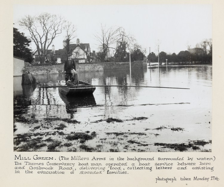
From 14-17 November all the riverside towns were badly flooded; high streets were underwater, roads and railways impassable.
In Reading, the flood waters covered Caversham Road and Great Knollys Street – despite the former having been raised by the Conservancy to reduce the risk. Residents of those and the surrounding roads moved upstairs, able only to come and go by boat. Thousands of people visited on Friday 18 November to see the floods and a horse-drawn coach offered a sight-seeing tour along Caversham’s Gosbrook Road.
‘The King’s Meadows, the Caversham Meadows, and the Sonning Meadows are completely submerged, the Thames presenting the appearance of an inland lake, stretching completely across to Lower Caversham.’
The Berkshire Chronicle, 17 November 1894
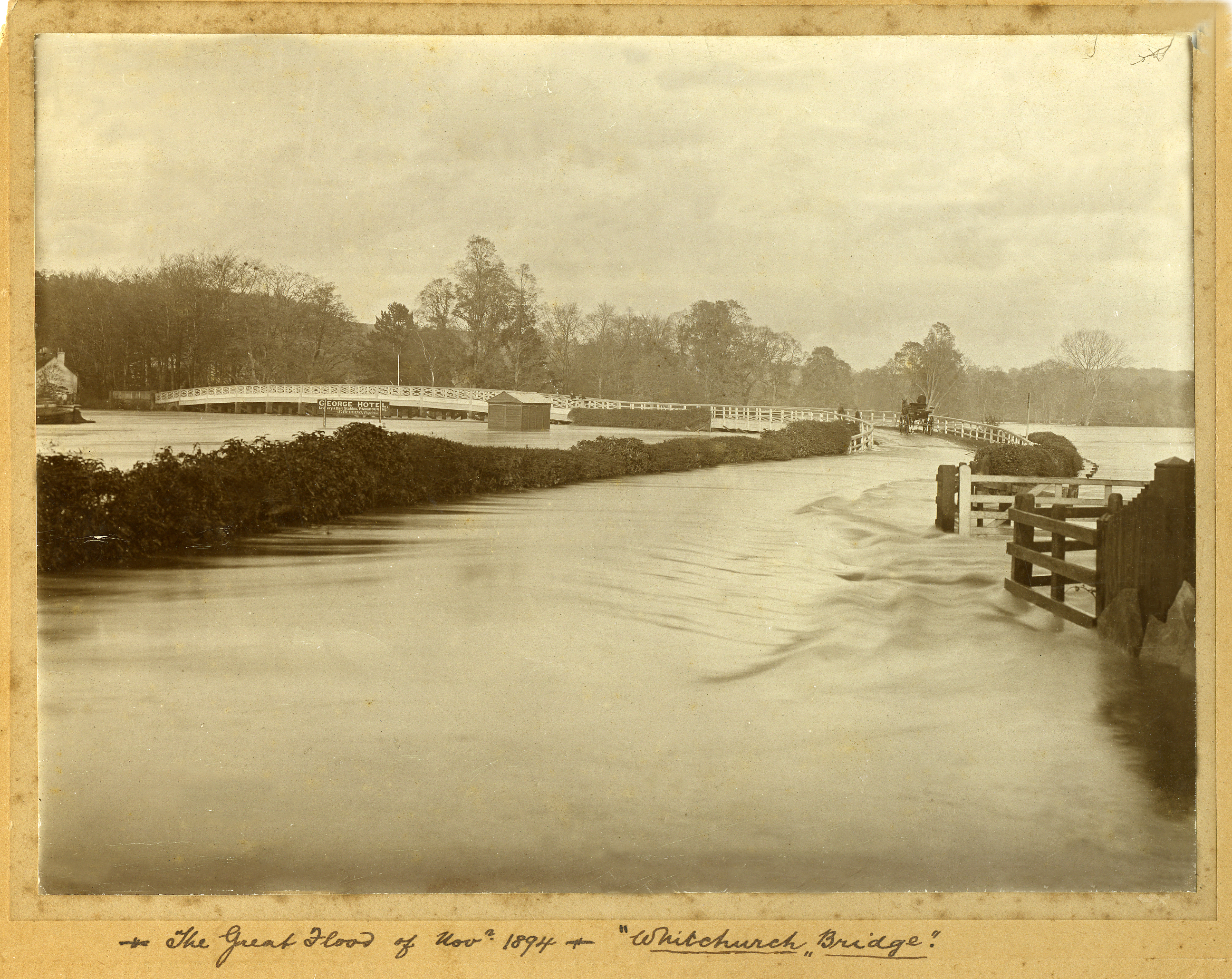
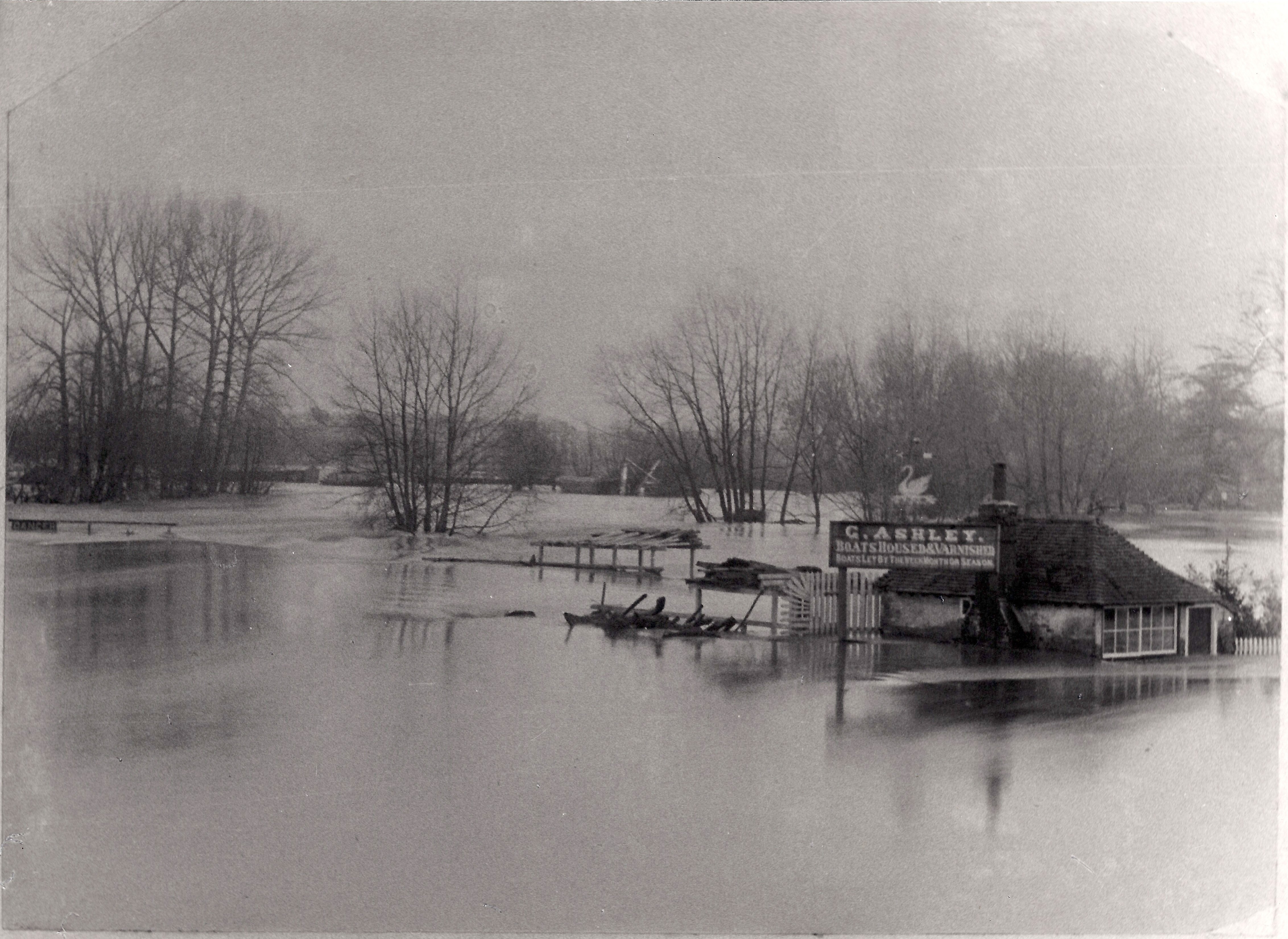
Photographs of the Great Flood at Whitchurch Bridge and Weir, 1894 (reproduced with permission of Pangbourne Heritage Group)
[Black and white photographs of Whitchurch Bridge under flood water with a horse and carriage attempting to cross; and a flooded Pangbourne Weir, showing a building with flood water coming just under the window and trees submerged up to the branches, the trunks are no longer visible.]
The waters peaked on 17 November, when Kingston was the last town to flood, and had receded by 20 November.
1947
The floods of March 1947 were due to three factors: snow-melt, frost and rain over an extended period. Blizzards during a harsh winter had frozen the upper reaches; the thaw was sudden and the effect severe. On 16 March there was a great storm that moved from south to north. Many rivers across the country flooded.
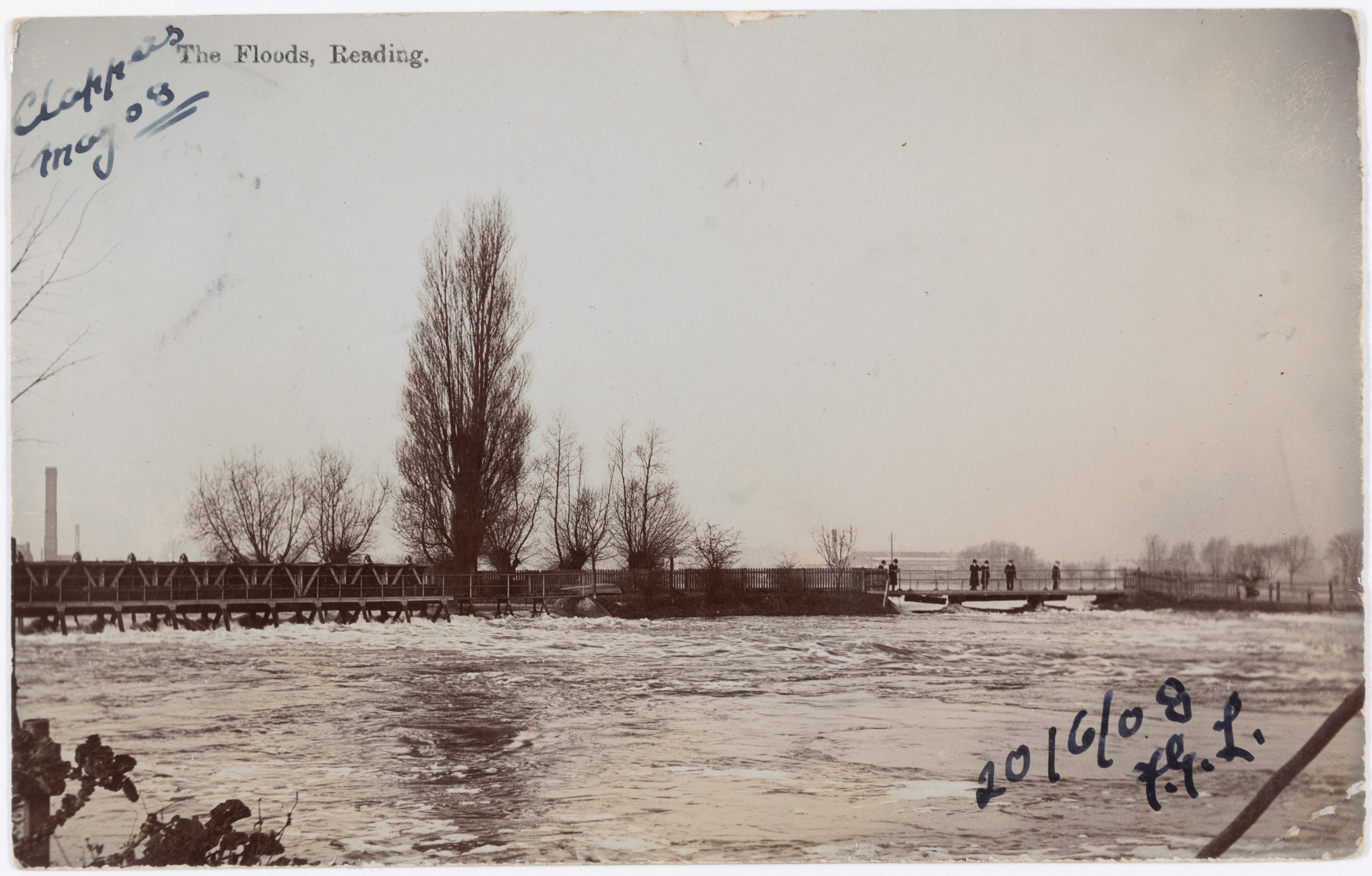
In the Thames, the period of highest water began on 14 March and lasted over a week, far longer than the flood of 1894. In the towns that reported properties flooded – Maidenhead, Reading and Windsor – the total number was over 4,000.
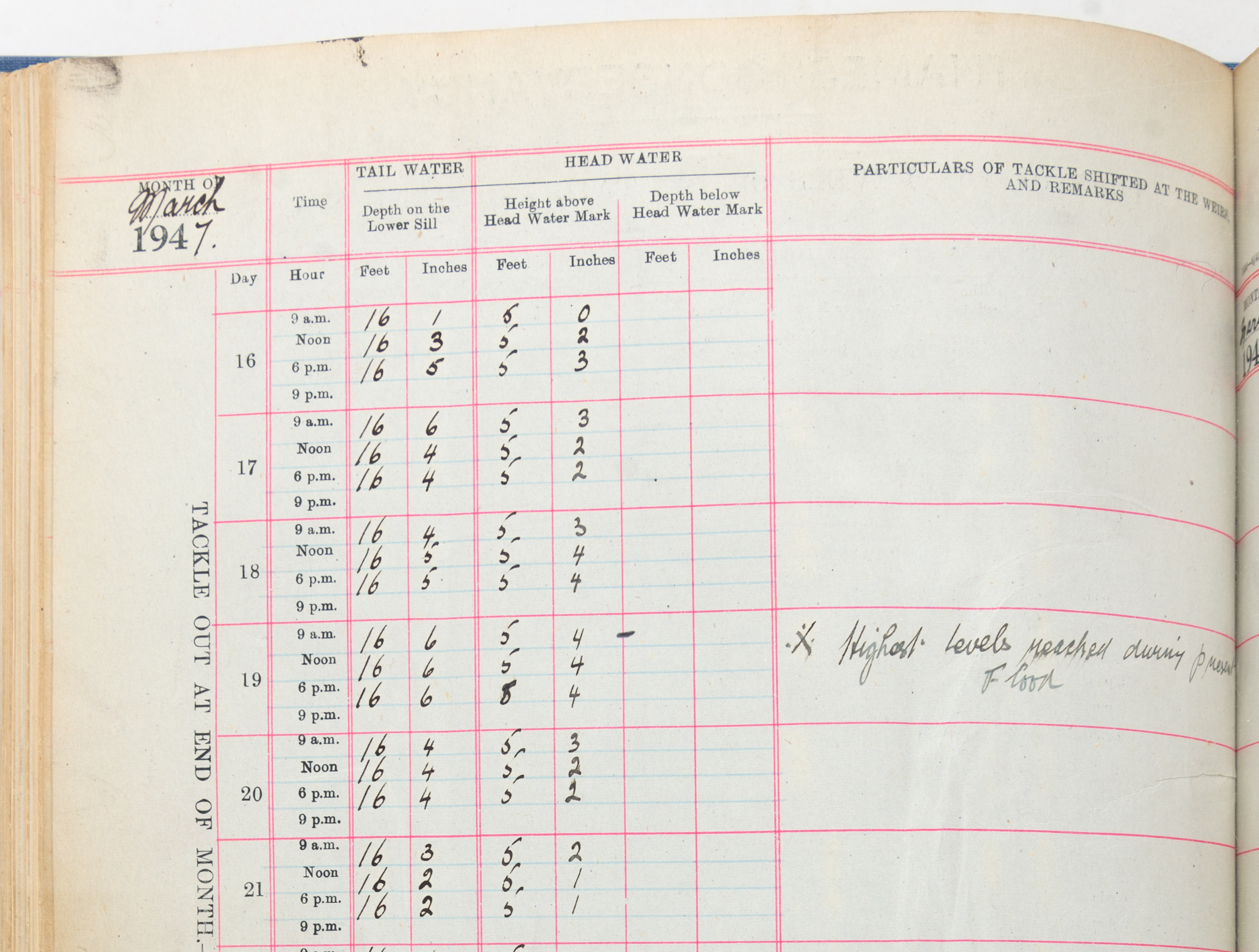
The river levels have been measured daily at Teddington weir since 1892. Both head (upstream of the lock) and tail (downstream) water levels are recorded. On 18 March 1947 the tail water peaked at 18 feet and 8 inches (5.7m).
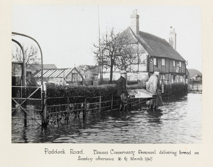
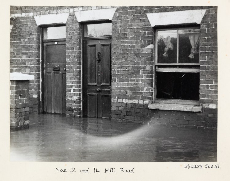
Photographs from album kept by then Reading Mayor, Phoebe Cusden, 1947, D/EX1485/14/10
Towards management of flood risks
Although the Conservancy was encouraged to prevent the ‘ordinary’ floods it was not given any powers to protect properties against exceptional events.
After the floods of 1894 and similar, though smaller events in 1900, 1907 and 1908, the Conservancy recognised that this put it in a difficult position. For the press and the public, it was the face of flood management along the river and the perception was that it could help.
The Conservancy decided to keep an eye on river levels. On 2 April 1909, Lord Desborough reported to the board:
‘I would suggest for your consideration that we should further appoint a new Committee, and this Committee would be certainly no less important than the navigation Purification Committee, and which would take over the works and the navigation and the control of the water. It would be an important Committee because, although we are not floods prevention authority in any way, we are the body controlling the weirs and must accept responsibility for doing everything we can in diminishing the damage caused by floods, and if have this Committee appointed we should have a Navigation Committee which in summer time would have the duty of keeping up the river to head the water level and keeping it down on times of excessive rainfall.’
Minutes of the Thames Conservancy Board, no.1,1909-1911, D/TC/A1/10
In time, the Conservancy did obtain some statutory powers to alleviate flooding. The Land Drainage Act 1930 made the Conservators into the drainage board for the Thames Catchment Area, inheriting the powers from earlier boards. They were able to deepen, widen or straighten the river. The focus, however, was more on protecting agricultural land than residential areas. It was only after the Conservancy’s time that flood defences became part of government expenditure on the river.

Marker at Mapledurham Lock showing flood levels recorded in March 1947 and January 2003, photograph by Ellie Thorne
