The Thames Conservancy changed the face of an iconic river. But it was not the first time that the river had changed.
The earliest settlers in the Thames Valley knew a waterway much wider than today, shallower, and surrounded by marshland. Settlements were few due to flooding though, where the river was at its lowest, it was possible to ford across. Bronze age finds suggest the river was already a place of trade.

The Romans incorporated some of these crossing points into their north-south highways, such as Watling Street, which crossed the river near Westminster, and the Icknield Way which crossed at Goring and Streatley. The first bridges were built at Wallingford and Staines. Over time, settlements began on the higher land along the banks. The river’s gentle fall and even current allowed for small boats and fishermen to use it.
It was during the middle ages that the river was first used as a transport highway. Towns developed at Oxford, Abingdon, Wallingford, Reading and Windsor. As the local population grew, so did the need for fish on the many days of religious abstinence from meat. The shape of the river was altered by human intervention, much of it by the monastic houses that were close by: marshes were drained to provide farmland; the river was dredged so that larger boats could use it; and the first weirs were built to control the flow of water. The houses traded with London or further afield.

Structures began to appear. Weirs controlled flooding and improved navigation, piers helped fishermen, and mills diverted water flow to provide power. The numbers of bridges and ferries increased. In the 13th century, flash locks were introduced: wooden bars set across the stream which allowed a head of water to build and could be released to carry a vessel downstream.
These all had the effect of changing water levels and obstructing use. In some places boats had to be taken out of the water and carried over the land. Heading upstream could involve cables and winches to pull a boat over a flash lock. Many landowners along the river also began to charge for passage over bridges or towpaths. Trade along the Thames was no longer flowing smoothly.

Initial attempts to address this were general statutes ordering the removal of obstructions from all major rivers. These met with little success. In 1605 and 1624 the first specific attempt was made to regulate the Thames: the Oxford and Burcot Commission was appointed to make the river fully navigable between those two places, a distance of 18 miles. The first pound locks – the enclosed structures that we know as locks today – were built at Iffley, Sandford and Abingdon. For the first time, large barges could go upstream from London to Oxford.
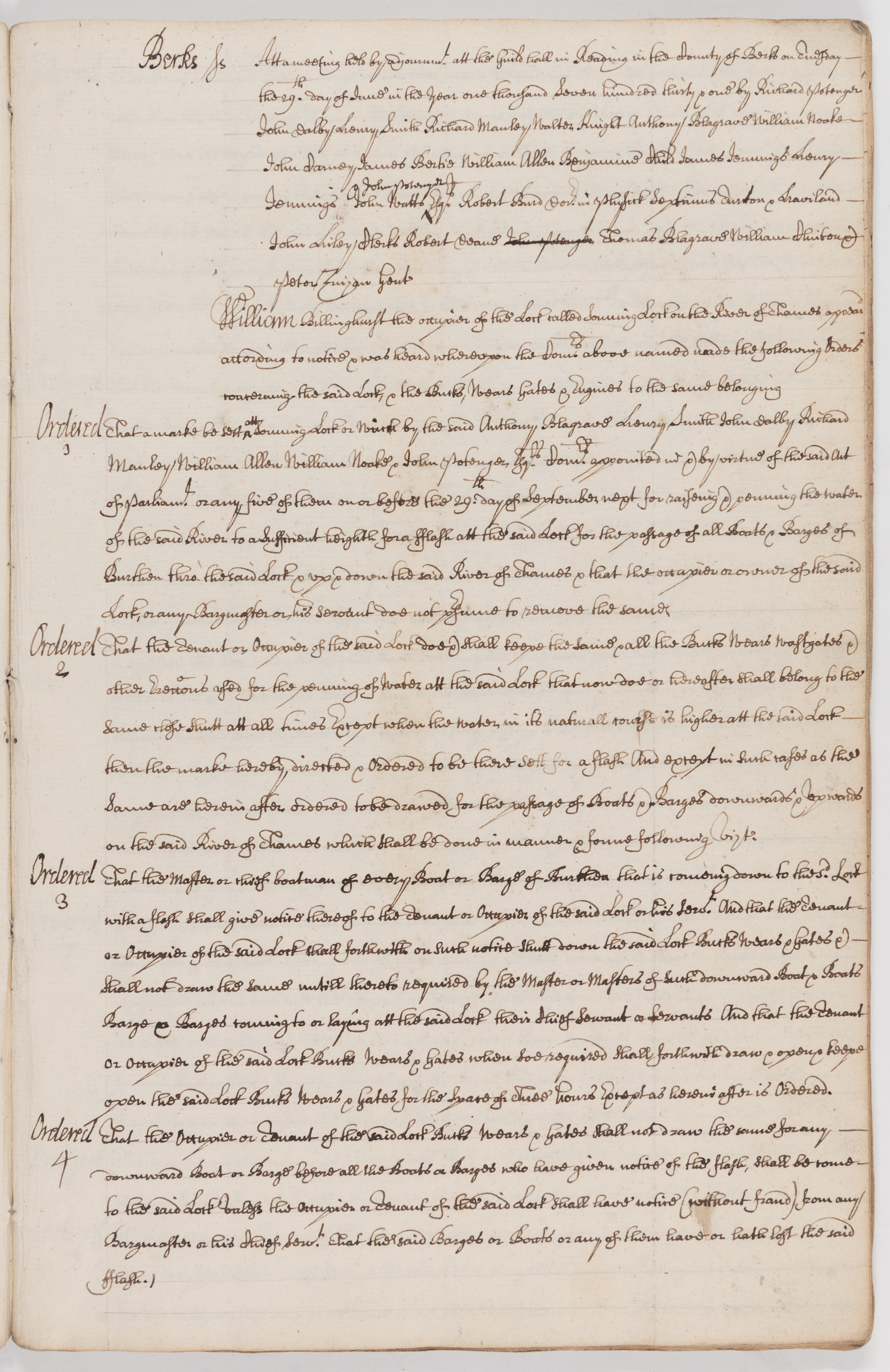
More piecemeal legislation followed. In 1695 the first law was passed to regulate fees for use of locks and other facilities along the length of the non-tidal river. County justices were appointed as local commissioners to agree the fees. This law was extended in 1730 and again in 1747.


Many barge owners made their living on the river. When bargeman William Raynolds of New Windsor died in 1598 he left his half of ‘the Barge uppon the Thames called the Diana .. and half the tackell to hir’ to his wife Margaret. His inventory values his share in the barge at £4. D/A1/111/121
The Thames at this time was described by Daniel Defoe in his Tour through the whole Island of Great Britain. Defoe wrote about the importance of river traffic between Reading and London:
‘Reading, a very large and wealthy town, handsomely built, the inhabitants rich, and driving a very great trade. The town lies on the River Kennet, but so near the Thames, that the largest barges which they use, may come up to the town bridge, and there they have wharfs to load, and upload them. … They send from hence to London by these barges, very great quantities of malt, and meal, and these are the two principal articles of their loadings, of which, so large are these barges, that some of them, as I was told, bring a thousand, or twelve hundred quarters of malt at a time. …. They also send very qreat quantities of timber from Reading; for Berkshire being a very-well wooded county, and the River Thames a convenient conveyance for the timber, they send most of it, and especially the largest and fairest of the timber, to London, which is generally bought by the shipwrights in the river’.
The significant investments that Defoe described, and the risks associated with their loss or delay, led to increasing demands for better government of the river. In 1751, Parliament expanded the local commissioners to cover the length of the navigable non-tidal river, from Cricklade to Staines. The new body was called the Thames Navigation Commission. But with Parliament dominated by landowners, the Commission represented those local interests rather more than the long-distance traders. The all-male commissioners were drawn from the river counties, representing all the major towns and the University of Oxford. They were required to have substantial property and were given very limited powers: they could settle charges for use of locks and issue warrants to owners who had shut their locks or weirs. But they could not enforce these warrants or carry out any major works along the river. All the old obstacles to transport remained.


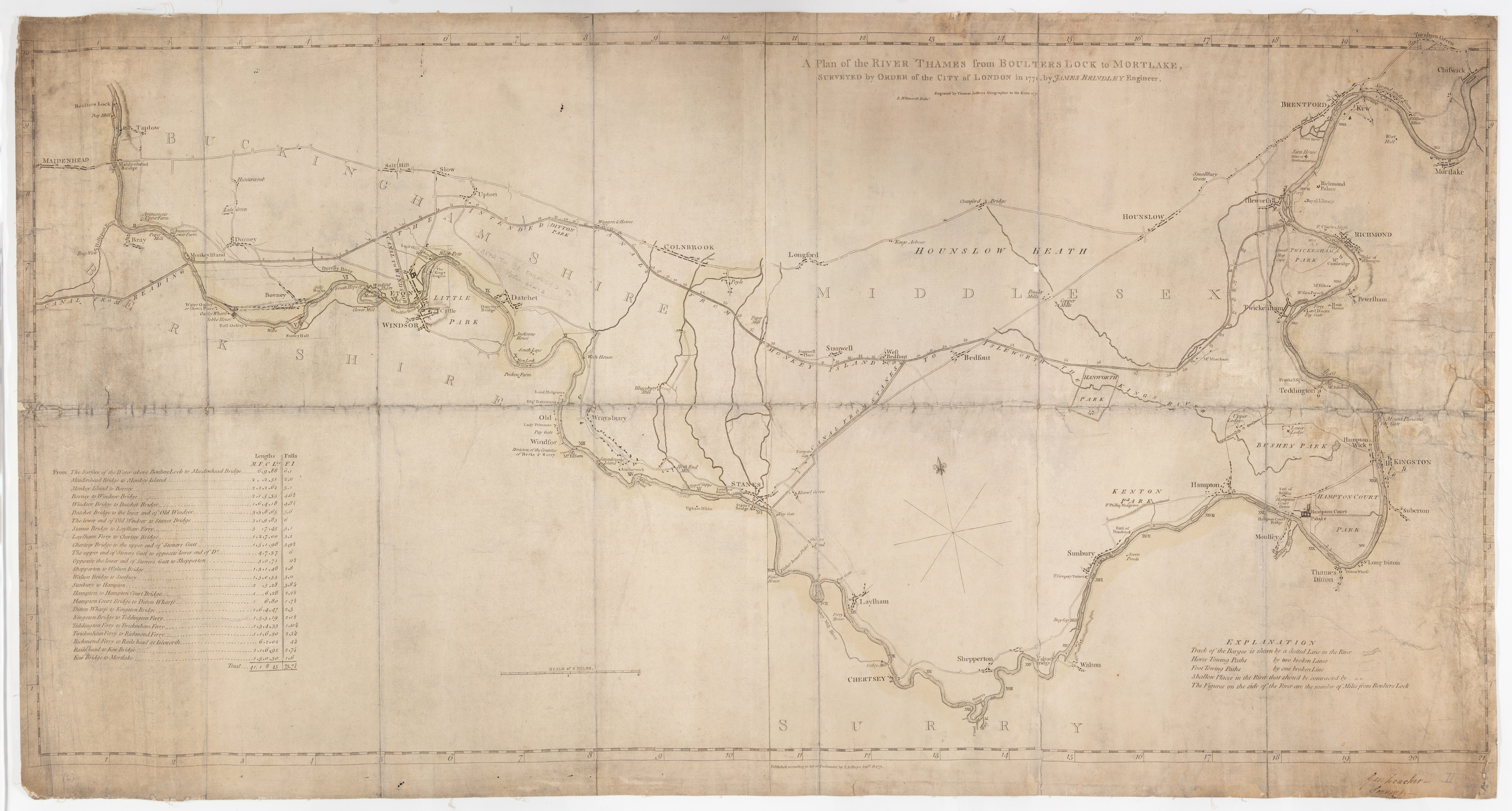
By 1770 the river’s condition was seriously hampering trade. It was claimed that you could not travel the Thames in winter due to flooding and in the summer due to shallow water. The City of London commissioned canal engineer James Brindley to survey the river between Boulter’s Lock and Mortlake, and he concluded that the obstructions to navigation were ‘considerable and many’.
Brindley proposed that a canal be built to bypass the river. He estimated that this would reduce the cost of transport fivefold and reduce barge times to London by 75%. Other speculators proposed another canal between Reading and Bray. Petitions for both were taken to Parliament and supported by the merchants in the City. Now, the landowners along the Thames were economically threatened. As a compromise, they supported greater powers for the existing Navigation Commission. A new Act was passed to give it the authority to build whatever it took to make the Thames a superhighway. On 9 May 1771 that Commission began its work.